


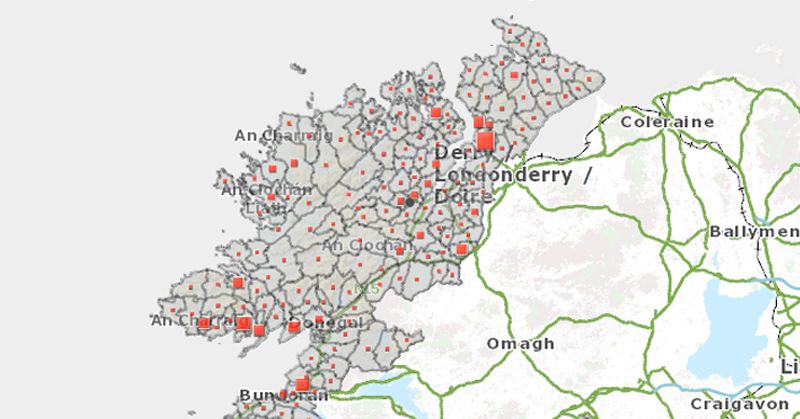
A new map system allows the public to find out how many cases of Covid-19 were confirmed in their local area since March.
The Department of Health’s new data hub shares more detailed data on Covid-19 in the community than ever before.
The live map is divided into electoral divisions to allow people to monitor the number of cases nearby by postcode search. Visit the dashboard page at: https://covid19ireland-geohive.hub.arcgis.com/
Donegal’s 470 confirmed cases are mapped out geographically – but people are advised to note that figures are based on cumulative cases to-date (total confirmed). A high proportion of such cases will have fully recovered within a 14 day period.
For confidentiality reasons, data is limited in areas where the number of confirmed cases is below five.
The data hub also shares the number of daily cases, deaths, number of people in hospital and ICU and a daily update on testing figures.
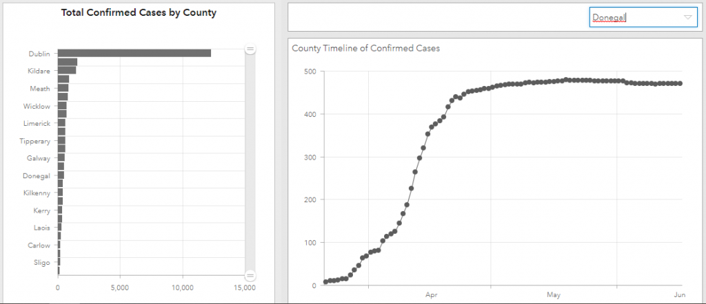
Ireland’s COVID-19 Data Hub: 23:00 18th June 2020
Speaking ahead of the dashboard launch, Dr Ronan Glynn, Deputy Chief Medical Officer, Department of Health, said: “The management of COVID-19 is an individual task, where we all must remain aware of the disease in our community, follow public health advice and adopt protective behaviours.”
Professor Philip Nolan, Chair of the NPHET Irish Epidemiological Modelling Advisory Group, said: “The reproductive number is now estimated to be close to 0.7. It is heartening to see that none of the data suggests that there is a significant increase of transmission of COVID-19 in the community since the commencement of Phase 2.”
Tags: