 DONEGAL Mountain Rescue Team has been chosen to use drones by the world’s biggest maker of them in European experiment on their uses in emergency situations.
Huge Chinese drone company DJI, which makes the best-selling Phantom and Inspire ranges of drones, today announced an official partnership with the European Emergency Number Association (Eena) that will try to integrate the use of drones into first-response missions.
Teams from the Donegal Mountain Rescue Team and Greater Copenhagen Fire Department will be trained on DJI’s SDK, M100 platform, and drone hardware, and will test the technology under various scenarios.
Donegal Mountain Rescue Team is already using the software with data being fed back to DJI.
“The team in Ireland is already using advanced software applications to help search and rescue missions and the focus will be to improve real-time networking techniques and crowd-sourcing capabilities,” said DMRT and the Danish fire office in a statement.
A DJI spokesman said that the drone-maker and Eena “expect to gain deeper understanding of how aerial technology best adds value to emergency-service providers in different scenarios, environments and conditions”.
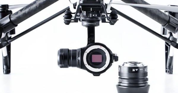
The joint DJI-Eena program will provide “carefully selected” teams of pilots in Europe with the latest aerial-technology equipment, including DJI’s ready-to-fly Phantom and Inspire drones, its M100 platform and Zenmuse XT thermal-imaging system.
Throughout the programme, selected teams will receive hands-on training, support and guidance on application-development using DJI’s software development kit.
A spokesman said that at the program’s end, Eena and DJI will share insights and “best practices” with the broader international emergency-response community to promote the integration of drones in emergency situations.
“With this partnership, we hope to demonstrate the power of aerial systems in first response missions,” said Romeo Durscher, DJI’s director of education.
“Drones are transforming the way first response and civil protection missions operate by not only helping commanders make faster, smarter and better informed decisions, but also by providing first responders with more detailed information from an aerial perspective. The technology is easy to deploy and can be used in dangerous situations without risking pilots’ lives. This ultimately saves lives and property.”
Tags:


