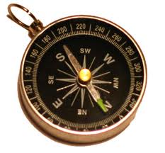
A unique talk on how to read maps and other navigation skills is to be given by the army in Letterkenny.
With such skills becoming much more useful with people enjoying the great outdoors across Donegal, the County Museum thought it was time to do something about it.
And so personnel from the 58 Battalion Reserve Defence Force will be in the Donegal County Museum next Saturday 28th January from 2pm to 3.30pm to help provide the basic elements and principles of map and compass use which may help you walk to safety, should you find yourself out after dark or suddenly disorientated by a change in weather.
They will also provide general safety advice and what is the essential equipment whether you are a novice or experienced walker.
Admission is free. For booking and enquiries, please contact Donegal County Museum, High Road, Letterkenny, Co Donegal T 074 9124163 E museum@donegalcoco.ie
This session is in association with the travelling exhibition from the National Library of Ireland – Ireland from Maps; currently on display in the Donegal County Museum This is the first venue in Ireland to host this new exhibition.
The earliest maps were simple representations of the landscape of ‘home’ scratched on to clay tablets. Several thousand years later, powerful satellites allow highly accurate maps to be made by anyone with access to a computer and an internet connection. The basic purposes of the map remain the same, however: to allow people to find their way from one point to another and to describe the features of a place.
Although the exhibition has broad appeal, the exhibition explores themes covered by the Curriculum in:
Fifth and sixth class students of Geography (SESE)
• Leaving Certificate Geography
• Junior Certificate Geography
The students would benefit from some of the supplementary learning activities and resources.
Admission is free to and all are welcome. For bookings contact Donegal County Museum, High Road, Letterkenny, Co Donegal T 074 9124163
E museum@donegalcoco.ie
ENDS
Tags: