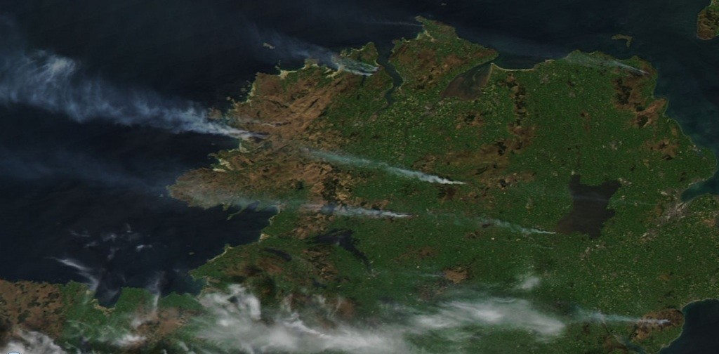
 THE extent of the gorse fires in various parts of Co Donegal became clearer today as it was revealed the smoke from them is visible from space.
As firefighters, Defence Forces and Air Corps personnel continued to tackle dozens of fires across the county, Irish Weather Online revealed they had spotted the smoke in a MODIS Aqua satellite image of Ireland, taken at 1:55 pm Irish time on Sunday, May 1st, 2011.
The stiff easterly wind that was crossing Ireland sends the smoke trails in Donegal straight out over the Atlantic.
The smoke over south west Donegal is clearly visible, as is smoke from a fire near Milford in the north of the county.
Fires in the Mourne mountains (visible in the lower right hand corner of the image) are also causing particular trouble today. Those fires are thought to have been started deliberately in at least 12 locations.
There is still concern about a major fire near Dungloe though officers believe they are now starting to take control.
More than 120 troops with specialist suits and three Air Corps helicopters have continued with efforts to tackle wild fires in the north west.
Three helicopters, two equipped with buckets able to carry 1,200 litres of water at a time, are being deployed to the scene to help firefighters on the ground.
More than 200,000 litres of water has now been dropped in a bid to stop the flames spreading.
The Defence Forces were drafted in yesterday as flames ripped through gorse and forest in the Doochary, Leitir and Dungloe.


